Washington Trail Conditions

← All trailheads

Sunday Lake Trail

Moderate · Out-and-back · 6.4 mi round trip · 363 ft gain · 2–2¾ hr

EF
Parkingnot reported today

A solid half-day for most hikers.

1,5001,900 0 mi 3.13 mi

Open the map ›

No hiker reports in the last 3 days. Be the first to report here

At this trail

Pack it out.

Parking passNorthwest Forest Pass, $5 per day or $30 per year or an America the Beautiful pass
PermitsDay hikes: none. Overnight: wilderness permit.
AreaSnoqualmie Ranger District ›
I-90, Middle Fork and Highway 410, Mt. Baker-Snoqualmie National Forest U.S. Forest Service

Rules, passes and closures change. Check the official Forest Service site before you go.

Getting there

Starts at Sunday Lake Trailhead

Navigate to the trailhead: Google Maps · Apple Maps · coordinates 47.66102, -121.61648

Right now

Open in the app to report

TodayAM42°24%
TonightPM33°28%
MonAM42°54%
MonPM37°70%
TueAM42°74%
TuePM38°86%
WedAM47°67%
WedPM41°97%

Slight Chance Rain And Snow, wind 1 to 5 mph · Full forecast ›

Daylight7:22 am 4:23 pm
Air qualityAQI 16 Good
WildfireKing fire, 34 km away, 3,427 acres, 95% contained
Snow0″ snow at Skookum Creek (3,320 ft, 2.6 km away)
Typical year: snowpack 29% of normal for the date · usually melted out by about May 26 · typical peak Apr 8
Snow levelabout 2,200 ft now · 2,100–5,400 ft over the next three days
PassSnoqualmie Pass I-90 32 km
Eastbound: No restrictions · Westbound: No restrictions · Bare and dry, wet in places · 31°F · pass report ›
Cameras
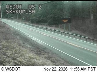
US 2 at MP 45.6 (Skykomish)
US 2 at MP 45.6 (Skykomish) · 17 km ›
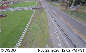
SR 203 at MP 5.2: NE Tolt Hill Rd
SR 203 at MP 5.2: NE Tolt Hill Rd · 23 km ›
No reports in the last 3 days.

All conditions and reports at Sunday Lake Trailhead

Something wrong on this page? Suggest a correction.