⚠ Road closed: Carbon River Road: no public vehicle access since April 22, 2025 (bridge closure). Walk or bike in from the Carbon River entrance. official status(checked 2026-10-05)
Navigate to the trailhead:Google Maps · Apple Maps · coordinates 46.99496, -121.91550
⚠ Fairfax Bridge Permanently ClosedThe Fairfax Bridge on State Highway 165 (milepost 11.5) across the Carbon River has been permanently closed by Washington Department of Transportation (DOT) due to safety concerns. The bridge closure prevents vehicle…Forest Service · May 6 · details ›
⚠ Paradise Road Status: Early Morning UpdateThe road is open to Longmire and the gate at Longmire to Paradise is expected to open at 10:00 a.m. All vehicles, including 4WD and AWD, must carry tire chains and be ready to use them. The gate at Longmire to Paradise…National Park Service · Nov 22 · details ›
⚠ SR 165 is closed at the Carbon River/Fairfax Bridge to all vehicles, bicyclists and pedestrians until further notice. The closure means there is no access acrosWSDOT · 13 km · Jul 6 · details ›
WILDFIRE CLOSURES: Sunrise & northern trails.Due to several active fires on the north side of the park, the following closures are in effect until further notice: Grand Park area & trails, Northern Loop Trail, Wonderland Trail from Carbon River Suspension Bridge…National Park Service · Nov 3 · details ›
TodayAM42°22%
TonightPM31°27%
MonAM45°46%
MonPM36°71%
TueAM47°79%
TuePM39°79%
WedAM49°64%
WedPM40°96%
Slight Chance Rain And Snow then Partly Sunny, wind 2 mph · Full forecast ›
Daylight7:21 am4:26 pm
Air qualityAQI 41 Good
WildfireWest Fork fire, 16 km away, 310 acres, 16% contained
Snow0″ snow at Burnt Mountain (4,160 ft, 5.8 km away) Typical year: snowpack 37% of normal for the date · usually melted out by about May 20 · typical peak Apr 6
Snow levelabout 2,400 ft now · 2,400–6,000 ft over the next three days
PassCrystal to Greenwater SR 41027 km Eastbound: Traction Tires Advised, Oversize Vehicles Prohibited. · Westbound: Traction Tires Advised, Oversize Vehicles Prohibited. · Bare and Wet. · 38°F · pass report ›
Cameras
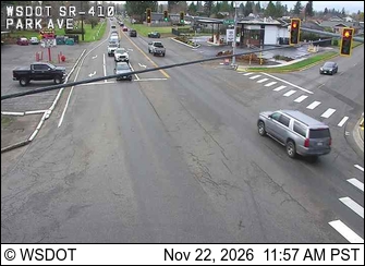
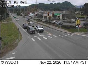
SR 410 at MP 21.4: Park Ave · 21 km ›SR 410 at MP 24.9: Watson Rd · 23 km ›