Pleasant Valley Loop
Moderate · Loop · 6.3 mi loop · 322 ft gain · 2–2¾ hr
River or creek
Parkingnot reported today
A well-marked trail. A solid half-day for most hikers.
No hiker reports in the last 3 days. Be the first to report here
At this trail
Dogs allowed Northwest Forest Pass Toilets (vault)
Pack it out.
Official pageForest Service › record checked 2026-10-06
RestrictionsWilderness regulations apply
Notein winter this is Hells Crossing Sno-Park (Washington State Parks): Sno-Park permit required November 1 to April 30
PermitsDay hikes: none. Overnight: wilderness permit.
AreaWhite Pass, Chinook Pass and the Naches side ›
Naches Ranger District, Okanogan-Wenatchee National Forest U.S. Forest Service
Officialconditions › · roads › · fees › · permits ›
Rules, passes and closures change. Check the official Forest Service site before you go.
Getting there
Starts at Pleasant Valley Loop Trailhead · 4 other trails start here. Also reachable from Wash Creek Trailhead
Navigate to the trailhead: Google Maps · Apple Maps · coordinates 46.96439, -121.26604
Right now
⚠ SR 410 Chinook Pass is closed for the season due to adverse conditions and avalanche risk. Eastbound closure is at milepost 57 Crystal Mountain Boulevard, 12 miWSDOT · 14 km · Nov 21 · details ›
TodayAM30°24%
TonightPM26°67%
MonAM28°67%
MonPM26°58%
TueAM31°80%
TuePM30°80%
WedAM36°59%
WedPM34°91%
Slight Chance Light Snow then Partly Sunny, wind 5 mph · Full forecast ›
Daylight7:18 am 4:24 pm
WildfireWest Fork fire, 34 km away, 310 acres, 16% contained
Snow6″ snow at Corral Pass (5,810 ft, 16.2 km away)
Typical year: snowpack 21% of normal for the date · usually melted out by about Jul 3 · typical peak Apr 25
Snow levelabout 1,900 ft now · 1,700–4,400 ft over the next three days · 2″ of new snow forecast in 48 h
PassChinook Pass SR 410 22 km
Eastbound: Closed for the season · Westbound: Closed for the season · SR 410 Chinook Pass is closed for the season due to adverse conditions and avalanche risk. Eastbound closure is at milepost 57, Crystal Mountain Boulevard, 12 miles west of the summit. Westbound closure is at milepost 74.5, Morse Creek, 5 miles east of the summit. · pass report ›
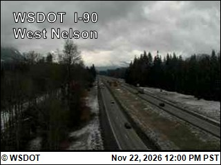
No reports in the last 3 days.
All conditions and reports at Pleasant Valley Loop Trailhead
Something wrong on this page? Suggest a correction.