Washington Trail Conditions

← All trailheads

Yellow Jacket

Moderate · Out-and-back · 4.8 mi round trip · 407 ft gain · 1½–2¼ hr

EF
Parkingnot reported today

A solid half-day for most hikers. Mountain bikes allowed.

3,0003,400 0 mi 2.24 mi

Open the map ›

No hiker reports in the last 3 days. Be the first to report here

At this trail

Dogs on leash Mountain bikes allowed Discover Pass

Pack it out.

Getting there

Starts at Squilchuck State Park Trailhead · 7 other trails start here

Navigate to the trailhead: Google Maps · Apple Maps · coordinates 47.31453, -120.37130

Right now

Open in the app to report

Burn Ban Level 2Wood fires restricted to fire pits in designated areas. Gas and propane allowed. Charcoal may be restricted.Washington State Parks · Jul 10 · details ›
TodayAM28°51%
TonightPM25°43%
MonAM33°43%
MonPM24°39%
TueAM28°66%
TuePM28°66%
WedAM32°39%
WedPM30°72%

Chance Light Snow, wind 2 mph · Full forecast ›

Daylight7:15 am 4:19 pm
Snow8″ snow at Upper Wheeler (4,330 ft, 3 km away)
Typical year: snowpack 110% of normal for the date · usually melted out by about May 11 · typical peak Mar 30
Snow levelabout 1,300 ft now · 1,300–3,500 ft over the next three days · 1.5″ of new snow forecast in 48 h
PassBlewett Pass US 97 16 km
Eastbound: Traction Tires Advised, Oversize Vehicles Prohibited. · Westbound: Traction Tires Advised, Oversize Vehicles Prohibited. · Mostly bare and wet with snow, slush and ice in places. · 30°F · pass report ›
Cameras
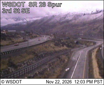
SR 28 Spur at MP 0.67
SR 28 Spur at MP 0.67 · 11 km ›
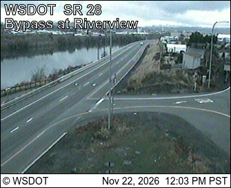
SR 28 at MP 4.64B: Bypass at Riverview
SR 28 at MP 4.64B: Bypass at Riverview · 11 km ›
No reports in the last 3 days.

All conditions and reports at Squilchuck State Park Trailhead

Something wrong on this page? Suggest a correction.