Columbia Plateau State Park Trail
Long-distance route · 129.9 mi
Wildlife
Parkingnot reported today
No hiker reports in the last 3 days. Be the first to report here
At this trail
Dogs on leash Discover Pass Toilets (vault) Trash cans
Official pageWashington State Parks ›
Getting there
Starts at Martin Road Trailhead
Navigate to the trailhead: Google Maps · Apple Maps · coordinates 47.28392, -117.82969
Right now
⚠ Part of the Park is ClosedPartial Trail Closure due to flooding washout between lower Monumental Dam and Kahlotus, WA until further notice.Washington State Parks · Oct 18 · details ›
Burn Ban No fires at any timeNo fires permitted at any time.Washington State Parks · Jan 1 · details ›
TodayAM35°72%
TonightPM29°9%
MonAM39°1%
MonPM30°1%
TueAM44°21%
TuePM36°36%
WedAM47°22%
WedPM38°74%
Light Snow Likely, wind 5 mph · Full forecast ›
Daylight7:05 am 4:09 pm
Air qualityAQI 33 Good
Snow levelabout 1,500 ft now · 1,500–5,300 ft over the next three days · 0.5″ of new snow forecast in 48 h
Cameras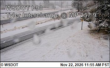
I-90 at MP 257.9: Tyler Interchange (1) · 17 km › 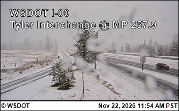
I-90 at MP 257.9: Tyler Interchange (2) · 17 km ›
No reports in the last 3 days.
All conditions and reports at Martin Road Trailhead
Something wrong on this page? Suggest a correction.