⚠ Paradise Road Status: Early Morning UpdateThe road is open to Longmire and the gate at Longmire to Paradise is expected to open at 10:00 a.m. All vehicles, including 4WD and AWD, must carry tire chains and be ready to use them. The gate at Longmire to Paradise…National Park Service · Nov 22 · details ›
⚠ SR 410 Chinook Pass is closed for the season due to adverse conditions and avalanche risk. Eastbound closure is at milepost 57 Crystal Mountain Boulevard, 12 miWSDOT · 8 km · Nov 21 · details ›
⚠ Beginning 10 a.m. Wednesday, Nov. 17, State Route 123/Cayuse Pass is closed from State Route 410 (milepost 16) to south of Stevens Canyon Road (milepost 2) for WSDOT · 2 km · Nov 18 · details ›
WILDFIRE CLOSURES: Sunrise & northern trails.Due to several active fires on the north side of the park, the following closures are in effect until further notice: Grand Park area & trails, Northern Loop Trail, Wonderland Trail from Carbon River Suspension Bridge…National Park Service · Nov 3 · details ›
TodayAM33°21%
TonightPM27°43%
MonAM34°85%
MonPM29°60%
TueAM36°84%
TuePM33°84%
WedAM40°68%
WedPM35°95%
Slight Chance Light Snow then Mostly Cloudy, wind 3 mph · Full forecast ›
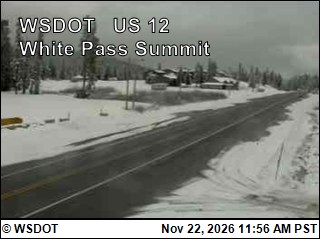
Snow1″ snow at Cayuse Pass (5,260 ft, 1.3 km away) Typical year: snowpack 15% of normal for the date · usually melted out by about Jun 28 · typical peak Apr 19
Snow levelabout 2,600 ft now · 1,900–5,200 ft over the next three days · 3.5″ of new snow forecast in 48 h
Winter roadChinook Pass (SR 410) and Cayuse Pass (SR 123) close each winter: SR 410 from Crystal Mountain Boulevard to Morse Creek, and SR 123 south to Stevens Canyon Road. Usually from November (October 24 in 2025) to late May. WSDOT ›
PassChinook Pass SR 4101 km Eastbound: Closed for the season · Westbound: Closed for the season · SR 410 Chinook Pass is closed for the season due to adverse conditions and avalanche risk. Eastbound closure is at milepost 57, Crystal Mountain Boulevard, 12 miles west of the summit. Westbound closure is at milepost 74.5, Morse Creek, 5 miles east of the summit. · pass report ›