Washington Trail Conditions

← All trailheads

Clearwater Trail

Strenuous · Out-and-back · 15.2 mi round trip · 2,715 ft gain · 6½–9 hr

EF
Parkingnot reported today

A long, demanding day; experienced hikers in good shape.

2,1004,900 0 mi 7.53 mi

Open the map ›

No hiker reports in the last 3 days. Be the first to report here

At this trail

Pack it out.

Parking passNorthwest Forest Pass, $5 per day or $30 per year or an America the Beautiful pass
PermitsDay hikes: none. Overnight: wilderness permit.
AreaSnoqualmie Ranger District ›
I-90, Middle Fork and Highway 410, Mt. Baker-Snoqualmie National Forest U.S. Forest Service

Rules, passes and closures change. Check the official Forest Service site before you go.

Getting there

Starts at Clearwater Trailhead

Navigate to the trailhead: Google Maps · Apple Maps · coordinates 47.06713, -121.84850

Right now

Open in the app to report

⚠ SR 165 is closed at the Carbon River/Fairfax Bridge to all vehicles, bicyclists and pedestrians until further notice. The closure means there is no access acrosWSDOT · 15 km · Jul 6 · details ›
Daylight7:22 am 6:24 pm
Air qualityAQI 32 Good
WildfireWest Fork fire, 17 km away, 310 acres, 16% contained
Snow0″ snow at Burnt Mountain (4,160 ft, 7.4 km away)
Typical year: normally snow-free now · usually melted out by about May 20 · typical peak Apr 6
PassCrystal to Greenwater SR 410 21 km
Eastbound: No restrictions · Westbound: No restrictions · pass report ›
Cameras
SR 410 at MP 21.4: Park Ave
SR 410 at MP 21.4: Park Ave · 17 km ›
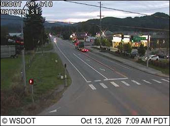
SR 410 at MP 24.9: Watson Rd
SR 410 at MP 24.9: Watson Rd · 18 km ›
No reports in the last 3 days.

All conditions and reports at Clearwater Trailhead

Something wrong on this page? Suggest a correction.