Mount Persis Trail
Strenuous · Out-and-back · 3.4 mi round trip · 2,609 ft gain · 2–3 hr
Parkingnot reported today
Steep: about 1,500 ft of climbing per mile. A long, demanding day; experienced hikers in good shape.
No hiker reports in the last 3 days. Be the first to report here
At this trail
Pack it out.
Parking passNorthwest Forest Pass, $5 per day or $30 per year or an America the Beautiful pass
PermitsDay hikes: none. Overnight: wilderness permit.
AreaSkykomish Ranger District ›
Stevens Pass and US-2, Mt. Baker-Snoqualmie National Forest U.S. Forest Service
Stevens Pass and US-2, Mt. Baker-Snoqualmie National Forest U.S. Forest Service
Officialconditions › · roads › · fees ›
Rules, passes and closures change. Check the official Forest Service site before you go.
Getting there
Starts at Mount Persis Trailhead
Navigate to the trailhead: Google Maps · Apple Maps · coordinates 47.79738, -121.63899
Right now
Daylight7:22 am 6:22 pm
Air qualityAQI 14 Good
WildfireLittle Bear fire, 40 km away
Snow1″ snow at Alpine Meadows (3,500 ft, 4.9 km away)
Typical year: normally snow-free now · usually melted out by about Jun 28 · typical peak Apr 19
Typical year: normally snow-free now · usually melted out by about Jun 28 · typical peak Apr 19
PassStevens Pass US 2 41 km
Eastbound: No restrictions · Westbound: No restrictions · pass report ›
Eastbound: No restrictions · Westbound: No restrictions · pass report ›
Cameras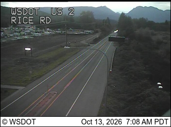
US 2 at MP 24.2: Rice Rd · 13 km › 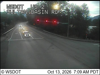
US 2 at MP 23.2: Sultan Basin Rd · 14 km ›
No reports in the last 3 days.
All conditions and reports at Mount Persis Trailhead
Something wrong on this page? Suggest a correction.