Washington Trail Conditions

← All trailheads

Three Corner Rock Trail

Moderate · Out-and-back · 3.8 mi round trip · 1,211 ft gain · 1½–2¼ hr

EF
Parkingnot reported today

A solid half-day for most hikers.

2,2003,400 0 mi 1.91 mi

Open the map ›

No hiker reports in the last 3 days. Be the first to report here

At this trail

Discover Pass

Pack it out.

Official pageDNR ›

Getting there

Starts at Three Corner Rock Trailhead

Navigate to the trailhead: Google Maps · Apple Maps · coordinates 45.72881, -122.05721

Right now

Open in the app to report

Fire RestrictionsThere are no current fire restrictions on the Gifford Pinchot National Forest. Even with lower fire risk please continue to practice safe fire habits: never leave a campfire unattended and make sure it is completely…Forest Service · Sep 18 · details ›
Daylight7:22 am 6:26 pm
Air qualityAQI 23 Good
WildfireHigh Lava fire, 17 km away, 2,899 acres, 95% contained
Snow1″ snow at North Fork (3,070 ft, 20.3 km away)
Typical year: normally snow-free now · usually melted out by about May 14 · typical peak Mar 22
Cameras
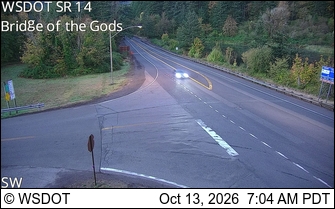
SR 14 at MP 41.5: Bridge of the Gods
SR 14 at MP 41.5: Bridge of the Gods · 14 km ›
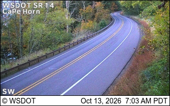
SR 14 at MP 23.9: CapeHorn
SR 14 at MP 23.9: CapeHorn · 21 km ›

No reports in the last 3 days.

All conditions and reports at Three Corner Rock Trailhead

Something wrong on this page? Suggest a correction.