Washington Trail Conditions

← All trailheads

Colville Mountain Loop

Easy · Loop · 3.6 mi loop · 620 ft gain · 1¼–1¾ hr

EF
Parkingnot reported today

Good for families, first hikes and short outings. Dogs on leash.

2,2002,700 0 mi 3.55 mi

Open the map ›

No hiker reports in the last 3 days. Be the first to report here

At this trail

Dogs on leash No fee or pass

Pack it out.

Official pageOfficial page ›
NoteCity of Colville, Colville Mountain Recreation Area: park along the west side of May Road
Noteno vehicle access up the mountain
Notepets on leash, no motorized vehicles
Noteno fee

Getting there

Starts at Colville Mountain Trailhead

Navigate to the trailhead: Google Maps · Apple Maps · coordinates 48.56596, -117.91317

Right now

Open in the app to report

TodayAM58°3%
TonightPM30°3%
WedAM63° 
WedPM33° 
ThuAM65° 
ThuPM34° 
FriAM68° 
FriPM37° 

Widespread Frost then Sunny, wind 2 mph · Full forecast ›

Daylight7:08 am 6:06 pm
Air qualityAQI 39 Good
WildfireHill Loop fire, 29 km away, 127 acres, 100% contained
Snow levelabout 3,100 ft now · 3,100–8,400 ft over the next three days
PassSherman Pass SR 20 42 km
Eastbound: No restrictions · Westbound: No restrictions · no current information available. The reporting has ended for this season. · 39°F · pass report ›
Cameras
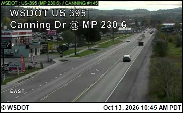
US 395 at MP 230.6: Colville - Canning Dr
US 395 at MP 230.6: Colville - Canning Dr · 1 km ›
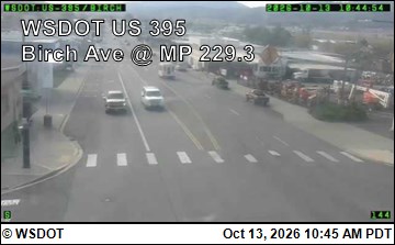
US 395 at MP 229.34: Colville - Birch Ave
US 395 at MP 229.34: Colville - Birch Ave · 3 km ›
No reports in the last 3 days.

All conditions and reports at Colville Mountain Trailhead

Something wrong on this page? Suggest a correction.