Lake Ann (Esmeralda Basin)
Hard · Out-and-back · 8.2 mi round trip · 2,220 ft gain · 3½–4¾ hr
Alpine lakeBig views
Parkingnot reported today
A full day with sustained climbing; bring plenty of water.
No hiker reports in the last 3 days. Be the first to report here
At this trail
Northwest Forest Pass Toilets
Pack it out.
Official pageForest Service › record checked 2026-10-06
Fee$5/vehicle/day or Northwest Forest Pass, or Interagency Pass required at trailhead. Discover Pass not valid on National Forest lands.
RestrictionsWilderness regulations apply. Dogs prohibited on Ingalls Way and Longs Pass trails.
Getting there
Starts at Esmeralda Trailhead · 4 other trails start here
Navigate to the trailhead: Google Maps · Apple Maps · coordinates 47.43673, -120.93703
Right now
TodayAM49°6%
TonightPM39°7%
WedAM53°7%
WedPM39°
ThuAM53°
ThuPM39°
FriAM57°
FriPM41°32%
Mostly Sunny, wind 3 to 8 mph · Full forecast ›
Daylight7:21 am 6:18 pm
Air qualityAQI 9 Good
WildfireKing fire, 24 km away, 3,427 acres, 36% contained
Snow0″ snow at Sasse Ridge (4,340 ft, 11.1 km away)
Typical year: normally snow-free now · usually melted out by about Jun 1 · typical peak Apr 7
Typical year: normally snow-free now · usually melted out by about Jun 1 · typical peak Apr 7
Snow levelabout 5,700 ft now · 5,700–9,400 ft over the next three days
PassBlewett Pass US 97 29 km
Eastbound: No restrictions · Westbound: No restrictions · pass report ›
Eastbound: No restrictions · Westbound: No restrictions · pass report ›
Cameras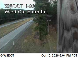
I-90 at MP 82.75: West Cle Elum Interchange · 27 km › 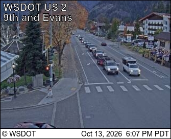
US 2 at MP 99.9: Leavenworth · 27 km ›
No reports in the last 3 days.
All conditions and reports at Esmeralda Trailhead
Something wrong on this page? Suggest a correction.