Commonwealth Basin Trail
Hard · Out-and-back · 6.6 mi round trip · 2,349 ft gain · 2¾–4 hr
Big views
Parkingnot reported today
A full day with sustained climbing; bring plenty of water.
No hiker reports in the last 3 days. Be the first to report here
At this trail
Northwest Forest Pass Toilets (vault) Trash cans
Official pageForest Service › record checked 2026-10-06
Fee$5/vehicle/day
RestrictionsTrail is closed to bicycles and motorized vehicles. Dogs must be on a leash. The Pacific Crest Trail travels through designated Wilderness w
PermitsDay hikes: none. Overnight: wilderness permit.
AreaSnoqualmie Ranger District ›
I-90, Middle Fork and Highway 410, Mt. Baker-Snoqualmie National Forest U.S. Forest Service
Officialconditions › · roads › · fees ›
Rules, passes and closures change. Check the official Forest Service site before you go.
Getting there
Starts at Pacific Crest Trail North - Snoqualmie Pass Trailhead · 7 other trails start here
⚠ Closed: Three Queens Fire: the Pacific Crest Trail north from Snoqualmie Pass is closed for about 50 miles to Stevens Pass through October 31, 2026 (Okanogan-Wenatchee order 06-17-03-2026-32). Kendall Katwalk is inside the closure; the Pacific Crest Trail Association lists a walking detour. official status (checked 2026-10-05)
Navigate to the trailhead: Google Maps · Apple Maps · coordinates 47.42782, -121.41343
Right now
Three Queens Fire Area Closure and Pacific Crest Trail closure/re-routeThis closure prohibits entry or use of roads, recreation sites, campgrounds and trails on national forest system lands within a defined area within the Cle Elum Ranger Districts to ensure the safety of the public and…Forest Service · Aug 11 · details ›
TodayPM52°3%
TonightPM43°12%
WedAM55°13%
WedPM43°
ThuAM60°
ThuPM43°
FriAM65°1%
FriPM43°77%
Partly Sunny, wind 2 mph · Full forecast ›
Daylight7:22 am 6:20 pm
Air qualityAQI 17 Good
WildfireThree Queens fire, 12 km away, 9,575 acres, 33% contained
Snow1″ snow at Olallie Meadows (4,010 ft, 6.4 km away)
Typical year: usually melted out by about Jun 22 · typical peak Apr 17
Snow levelabout 9,000 ft now · 7,800–9,100 ft over the next three days
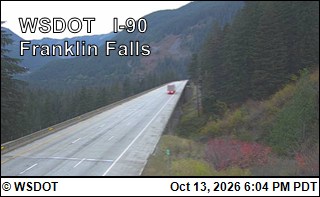
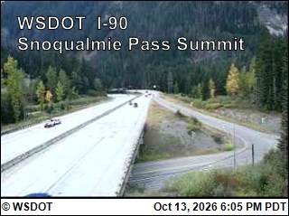
PassSnoqualmie Pass I-90 2 km
Eastbound: No restrictions · Westbound: No restrictions · 53°F · pass report ›
No reports in the last 3 days.
All conditions and reports at Pacific Crest Trail North - Snoqualmie Pass Trailhead
Something wrong on this page? Suggest a correction.