Washington Trail Conditions

← All trailheads

Ashford Trail

Easy · Out-and-back · 1.2 mi round trip · 151 ft gain · 25–35 min

River or creek

EF
Parkingnot reported today

Good for families, first hikes and short outings.

200400 0 mi 0.41 mi

Open the map ›

No hiker reports in the last 3 days. Be the first to report here

At this trail

Pack it out.

Getting there

Starts at Ashford Trail Trailhead

Navigate to the trailhead: Google Maps · Apple Maps · coordinates 47.68991, -122.11070

Right now

Open in the app to report

⚠ Up to two lanes of southbound I-405 from 112th Avenue Southeast / Lake Washington Boulevard Southeast (milepost 8.5) to Northeast 44th Street (milepost 7.4) wilWSDOT · 17 km · Oct 13 · details ›
⚠ Monday, Oct. 5, on most weeknights until Friday, Oct. 23 - The westbound SR 520 off-ramp to northbound I-5 and East Roanoke Street will close for construction nWSDOT · 16 km · Oct 6 · details ›
TodayAM61°7%
TonightPM50°11%
WedAM65°11%
WedPM46° 
ThuAM73° 
ThuPM50° 
FriAM76°2%
FriPM54°58%

Mostly Cloudy, wind 1 mph · Full forecast ›

Daylight7:26 am 6:22 pm
Air qualityAQI 17 Good
WildfireLittle Bear fire, 17 km away
Snow levelabout 8,300 ft now · 8,000–9,400 ft over the next three days
Cameras
SR 520 at MP 12.8: Redmond Way
SR 520 at MP 12.8: Redmond Way · 2 km ›
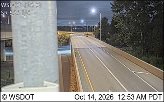
SR 202 at MP 7.7: SR 520 Interchange
SR 202 at MP 7.7: SR 520 Interchange · 2 km ›

No reports in the last 3 days.

All conditions and reports at Ashford Trail Trailhead

Something wrong on this page? Suggest a correction.