Indian Creek Trail (Teanaway)
Strenuous · Out-and-back · 15 mi round trip · 2,276 ft gain · 5¾–8 hr
Ridge or pass
Parkingnot reported today
A long, demanding day; experienced hikers in good shape.
No hiker reports in the last 3 days. Be the first to report here
At this trail
Pack it out.
Getting there
Starts at Iron Creek Trailhead · 1 other trail starts here
Navigate to the trailhead: Google Maps · Apple Maps · coordinates 47.35573, -120.71766
Right now
ℹ Indian Creek Road and Trail Motorized Use Closure on the Naches Ranger DistrictThis forest order prohibits motorized vehicle use on Naches Ranger District Road and trail.Forest Service · Jul 15 · details ›
TonightPM34°2%
TueAM52°4%
TuePM40°3%
WedAM57°3%
WedPM39°
ThuAM55°
ThuPM40°
FriAM58°
Mostly Clear, wind 0 mph · Full forecast ›
Daylight7:21 am 6:15 pm
Air qualityAQI 13 Good
WildfireThree Queens fire, 41 km away, 9,575 acres, 33% contained
Snow0″ snow at Blewett Pass (4,240 ft, 2.9 km away)
Typical year: usually melted out by about Apr 29 · typical peak Mar 12
Typical year: usually melted out by about Apr 29 · typical peak Mar 12
Snow levelabout 5,500 ft now · 5,000–9,300 ft over the next three days
PassBlewett Pass US 97 11 km
Eastbound: No restrictions · Westbound: No restrictions · 44°F · pass report ›
Eastbound: No restrictions · Westbound: No restrictions · 44°F · pass report ›
Cameras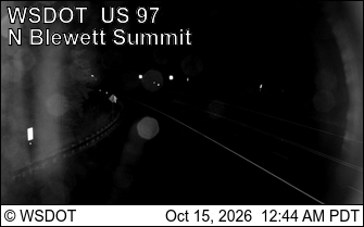
US 97 at MP 163.8: Blewett Pass Summit · 11 km › 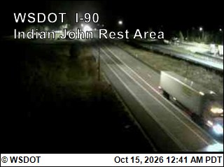
I-90 at MP 89.4: Indian John Hill · 24 km ›
No reports in the last 3 days.
All conditions and reports at Iron Creek Trailhead
Something wrong on this page? Suggest a correction.