← All trailheads · Snoqualmie Pass / I-90
Hyak Trailhead
4 trails start here · Snoqualmie Pass / I-90
Parkingnot reported today
No hiker reports in the last 3 days. Be the first to report here
Open in the app (live map, alerts, offline maps)
At this trailhead
Dogs on leash Discover Pass Toilets
Pack it out.
Official pageWashington State Parks ›
Notein winter this is Hyak Sno-Park (Washington State Parks): Sno-Park permit required November 1 to April 30
Notewith a season permit, the Special Groomed Trail permit is also required here
PermitsDay hikes: none. Overnight: wilderness permit.
AreaSnoqualmie Ranger District ›
I-90, Middle Fork and Highway 410, Mt. Baker-Snoqualmie National Forest U.S. Forest Service
Officialconditions › · roads › · fees ›
Rules, passes and closures change. Check the official Forest Service site before you go.
Getting there
Navigate to: Google Maps · Apple Maps · coordinates 47.39138, -121.39268
Trails from this trailhead
- Palouse to Cascades State Park Trail · Long-distance route · 248.2 mi
- Roaring Ridge via Road 9070 (snowshoe route) · Out-and-back · 5.7 mi one way · 1,823 ft gain · 4–5¾ hr · Hard
- Surveyors Lake (snowshoe route) · Out-and-back · 3 mi one way · 1,403 ft gain · 2¼–3¼ hr · Moderate
- Windy Pass and Mount Catherine (snowshoe route) · Out-and-back · 5.9 mi one way · 2,548 ft gain · 4½–6¼ hr · Strenuous
Right now
⚠ Part of the Park is ClosedThe trestle at Revere is temporary closed for repairs. Revere Road can be utilized as a detour.Washington State Parks · Jul 2 · details ›
Burn Ban No fires at any timeNo fires permitted at any time.Washington State Parks · Jun 9 · details ›
ℹ NotificationThe Snoqualmie Tunnel will be closing for the winter season at dusk on Oct 31st, 2026. It is scheduled to reopen in May depending on snow/ice conditions.Washington State Parks · Oct 30 · details ›
ℹ ConstructionConstruction will occur on the Palouse to Cascades State Park Trail beginning at the intersection with Hole-In-The-Ground Rd. heading West for 3.5 miles. This work is set to start December 2026 and end June 2027. The…Washington State Parks · Oct 14 · details ›
TodayAM35°45%
TonightPM29°49%
MonAM35°49%
MonPM32°37%
TueAM36°69%
TuePM33°69%
WedAM41°63%
WedPM36°99%
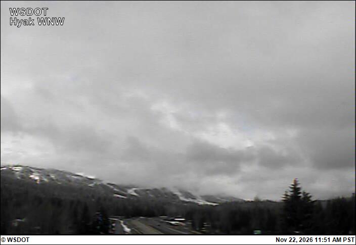
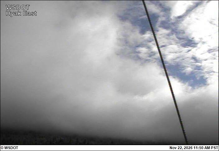
Chance Light Snow, wind 3 mph · Full forecast ›
Daylight7:20 am 4:23 pm
Air qualityAQI 16 Good
WildfireThree Queens fire, 10 km away, 9,575 acres, 95% contained
Snow1″ snow at Olallie Meadows (4,010 ft, 4.2 km away)
Typical year: snowpack 22% of normal for the date · usually melted out by about Jun 22 · typical peak Apr 17
Snow levelabout 2,400 ft now · 1,800–4,900 ft over the next three days · 3″ of new snow forecast in 48 h
PassSnoqualmie Pass I-90 2 km
Eastbound: No restrictions · Westbound: No restrictions · Bare and dry, wet in places · 31°F · pass report ›
No reports in the last 3 days.
Trail updates are public. The summary uses the last 6 hours (trail state the last 3 days); older reports stay in the history so seasons can be compared. Times are Pacific. Something wrong on this page? Suggest a correction.