⚠ Part of the Park is ClosedPartial Trail Closure due to flooding washout between lower Monumental Dam and Kahlotus, WA until further notice.Washington State Parks · Oct 18 · details ›
Burn Ban No fires at any timeNo fires permitted at any time.Washington State Parks · Jan 1 · details ›
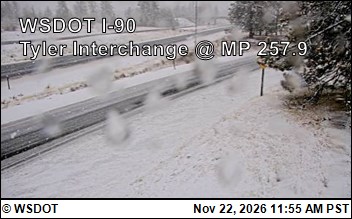
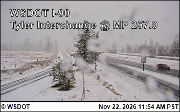
Snow levelabout 1,400 ft now · 1,400–4,800 ft over the next three days · 0.5″ of new snow forecast in 48 h
Cameras
I-90 at MP 257.9: Tyler Interchange (1) · 11 km ›I-90 at MP 257.9: Tyler Interchange (2) · 11 km ›
No reports in the last 3 days.
Trail updates are public. The summary uses the last 6 hours (trail state the last 3 days); older reports stay in the history so seasons can be compared. Times are Pacific. Something wrong on this page? Suggest a correction.