ℹ Blue Lake Vehicle RestrictionsUsing or having a vehicle is not allowed in the area from the nearby parking lot near the junction of Trail #271 and Trail #271A to high waterline of Blue Lake and land surrounding the lake for a distance of 150 feet.Forest Service · Jun 14 · details ›
⚠ Beginning Monday, April 27th, 2026, until further notice: Both directions of SR 504 at milepost 45.0 remain CLOSED at the winter gate for construction to rebuilWSDOT · 16 km · Jul 28 · details ›
⚠ Beginning Monday, April 27, until further notice: Crews are rebuilding the SR 504 Spirit Lake Outlet Bridge over South Coldwater Creek between mileposts 49-49.2WSDOT · 16 km · May 5 · details ›
Fire RestrictionsThere are no current fire restrictions on the Gifford Pinchot National Forest. Even with lower fire risk please continue to practice safe fire habits: never leave a campfire unattended and make sure it is completely…Forest Service · Sep 18 · details ›
Snow6″ snow at Swift Creek (4,440 ft, 4.5 km away) Typical year: snowpack 59% of normal for the date · usually melted out by about Jun 28 · typical peak Apr 22
Snow levelabout 2,200 ft now · 2,200–5,600 ft over the next three days · 3″ of new snow forecast in 48 h
Cameras
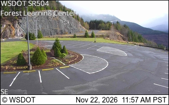
SR 504 at MP 33: Forest Learning Rest Area Center · 22 km ›
No reports in the last 3 days.
Trail updates are public. The summary uses the last 6 hours (trail state the last 3 days); older reports stay in the history so seasons can be compared. Times are Pacific. Something wrong on this page? Suggest a correction.