White River Trailhead
6 trails start here · Washington
Parkingnot reported today
No hiker reports in the last 3 days. Be the first to report here
Open in the app (live map, alerts, offline maps)
At this trailhead
Dogs allowed Northwest Forest Pass Toilets (vault)
Pack it out.
Official pageForest Service › record checked 2026-10-06
Fee$5/vehicle/day
RestrictionsWilderness regulations apply
PermitsDay hikes: none. Overnight: wilderness permit.
AreaEnchantments and Leavenworth ›
Wenatchee River Ranger District, Okanogan-Wenatchee National Forest U.S. Forest Service
Officialconditions › · roads › · fees › · permits ›
Rules, passes, permits and closures change. Check the official Forest Service site before you go.
Getting there
⚠ Closed: Little Giant Fire closure (order 06-17-07-2026-40, updated Sep 4, through Oct 31, 2026): national forest lands, roads and trails in the Chiwawa and White River valleys north of Lake Wenatchee are closed, including the Chiwawa River Road area, Forest Service Road 6400 (White River Road) and the White River Trail. Check the closure map before driving in. official status (checked 2026-10-05)
Navigate to: Google Maps · Apple Maps · coordinates 47.96283, -120.94499
Trails from this trailhead
- Clark Mountain Trail · Out-and-back · 9.4 mi one way · 3,903 ft gain · 7–10 hr · Strenuous
- Glacier Peak Loop · Long-distance route · 82 mi
- Indian Creek Trail · Out-and-back · 11.6 mi one way · 2,693 ft gain · 7¾–11 hr · Strenuous
- Mount David Trail · Out-and-back · 6.5 mi one way · 5,197 ft gain · 6–8½ hr · Strenuous
- Panther Creek Trail · Out-and-back · 4.1 mi one way · 1,093 ft gain · 3–4¼ hr · Hard
- White River Trail · Out-and-back · 14 mi one way · 3,250 ft gain · 9½–13¼ hr · Strenuous
Right now
ℹ Indian Creek Road and Trail Motorized Use Closure on the Naches Ranger DistrictThis forest order prohibits motorized vehicle use on Naches Ranger District Road and trail.Forest Service · Jul 15 · details ›
TodayAM31°26%
TonightPM21°59%
MonAM30°59%
MonPM28°43%
TueAM32°89%
TuePM31°89%
WedAM36°78%
WedPM35°100%
Chance Light Snow, wind 5 mph · Full forecast ›
Daylight7:20 am 4:19 pm
Air qualityAQI 39 Good
WildfireSisi fire, 44 km away, 4,816 acres, 90% contained
Snow0″ snow at Trinity (2,890 ft, 14.3 km away)
Typical year: snowpack 11% of normal for the date · usually melted out by about May 13 · typical peak Mar 19
Snow levelabout 2,100 ft now · 1,500–4,100 ft over the next three days · 6.5″ of new snow forecast in 48 h
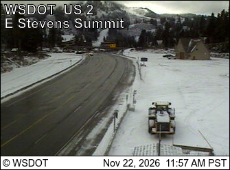
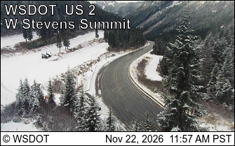
PassStevens Pass US 2 27 km
Eastbound: Traction Tires Advised, Oversize Vehicles Prohibited. · Westbound: Traction Tires Advised, Oversize Vehicles Prohibited. · Snow slush and ice in places · 32°F · pass report ›
No reports in the last 3 days.
Trail updates are public. The summary uses the last 6 hours (trail state the last 3 days); older reports stay in the history so seasons can be compared. Times are Pacific. Something wrong on this page? Suggest a correction.