Raging Ridge Trail
Strenuous · Out-and-back · 16.6 mi round trip · 2,567 ft gain · 6–8¼ hr
Parkingnot reported today
A long, demanding day; experienced hikers in good shape. Dogs on leash.
No hiker reports in the last 3 days. Be the first to report here
At this trail
Dogs on leash Discover Pass Toilets
Pack it out.
Official pageDNR ›
NoteWashington DNR, Raging River State Forest: Snoqualmie Point Trailhead, I-90 exit 27, turn right, 0.25 mile
Notea 17-mile mountain-bike-oriented single-track system with opportunities for hikers, plus the hiker-only Rattlesnake Mountain Trail
Noteday use only
Notedogs on leash
NoteDiscover Pass
Getting there
Starts at Rattlesnake Mountain Trailhead · 3 other trails start here
Navigate to the trailhead: Google Maps · Apple Maps · coordinates 47.50922, -121.84418
Right now
⚠ Eastbound Exit 38 near North Bend: The Snoqualmie River Bridge on Homestead Valley Road will be closed due to bridge repairs. Traffic will need to return to I-9WSDOT · 15 km · Oct 10 · details ›
TodayAM57°7%
TonightPM48°11%
WedAM60°14%
WedPM47°
ThuAM70°
ThuPM52°
FriAM71°2%
FriPM50°67%
Partly Sunny, wind 0 to 3 mph · Full forecast ›
Daylight7:23 am 6:23 pm
Air qualityAQI 18 Good
WildfireLittle Bear fire, 44 km away
Snow0″ snow at Skookum Creek (3,320 ft, 26.2 km away)
Typical year: normally snow-free now · usually melted out by about May 26 · typical peak Apr 8
Typical year: normally snow-free now · usually melted out by about May 26 · typical peak Apr 8
Snow levelabout 6,700 ft now · 6,700–9,400 ft over the next three days
PassSnoqualmie Pass I-90 35 km
Eastbound: No restrictions · Westbound: No restrictions · 42°F · pass report ›
Eastbound: No restrictions · Westbound: No restrictions · 42°F · pass report ›
Cameras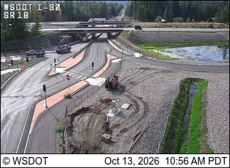
I-90 at MP 25.68: SR 18 Interchange · 3 km › 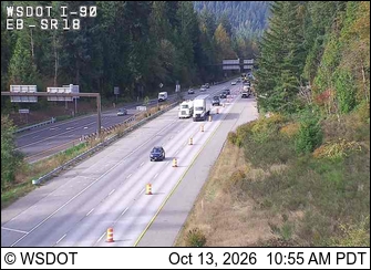
I-90 at MP 25.66: Eastbound at SR 18 · 3 km ›
No reports in the last 3 days.
All conditions and reports at Rattlesnake Mountain Trailhead
Something wrong on this page? Suggest a correction.